Seward

I am having a hard time getting back into the swing of the trip.  After the weekend back east for my Pop’s funeral, my enthusiasm to post has waned.  I wanted a blog so that he could experience the trip with me.  I miss him.   Here are some pictures I think he would have liked.

Portage Glacier (I think)
Baltimore Oriole @ Ottertail Lake, MN

DSC_0451

Our first Bison in Saskatchewan.
View of Denali from Talkeetna River.

What a weekend!

Hello from Talkeetna!

Talkeetna is located about 60 miles south east of Denali at the confluence of 3 rivers, the Chilutna, Susitna and Talkeetna, with the Alaska Range to the west and the Talkeetna Range to the east.  It was originally settled as a temporary supply camp for the building of the Alaska railroad.  When the railroad was completed the town continued to support trappers and traders who worked the area.  Today it is a bustling little town full of local color, flavor and tourists.  It provides land, air and water sightseeing opportunities and is also a staging area for those crazies who want to climb “the mountain” as Denali is affectionately referred to here.  We have thoroughly enjoyed our stay.  Next time I would like to have the kids come along.  I might lose David to the place.  I think he could find his niche here.

Here are some pictures from our adventures here.

Pilot Jason talking to Don & Sandy's grandson who was a little nervous.
Pilot Jason talking to Don & Sandy’s grandson who was a little nervous.
Fliyng over a glacier

DSC_0846

Devil's Canyon.
Devil’s Canyon.
Devil's Canyon Susitna River.
Devil’s Canyon Susitna River.

Whitehorse, YT

Hi All,

I am sorry I have not  posted any pictures.  Internet is at a premium here.  We have been making good time across Canada.  The Alaska Highway is magnificent!  My only complaint is the forest is so thick and tall it is hard to capture the grandeur of the scenery.  We have spotted some animal wildlife.  I spotted a wolf.  At first I thought it was a dead tree stump, then I saw the face.  I did not get a picture.  Next we saw 3 female moose licking the yellow line in the middle of the road.  We chastised mom for teaching her young ones such dangerous behavior.  After the moose we saw 2 herds of goat/sheep. I am not sure which; I have to ask someone.  We saw 3 young black bear and 5 bison.  Bob was focused on managing the RV through the Canadian Rockies so he did not get to ogle as much as I did.  I got some good pictures for him.  Yesterday was an exciting day.

Today’s drive was much tamer.  No wildlife, shorter rises and falls and fewer curves to negotiate.  We are settled in Whitehorse for the next two days.  We are taking a bus/narrow gauge train trip to Skagway tomorrow.  Even though we will be moving, we will be happy to leave the driving to someone else. Back on the road to TOK, AK on Wednesday, then meet up with Don  & Sandy Marohl on Thursday the 7th.

I miss all of you!

A special hug to Pop and one to Judi for taking care of him. XOXOXOXO

Love, Cora

Fort Nelson

Hi Loved Ones,

We traveled across Saskatchewan, Alberta and a good ways through British Columbia.  Alaska is looking like a reality.  We are meeting more and more folks headed that way too.  Tonight we are camped with 5 couples we camped with last night as well.  It seems we are lucky to be between group caravan tours.  Traffic has been very light and the roads are in better condition than I expected.  When I consider the vastness of the highway and the long distances between outcroppings  of civilization I am amazed the roads exist at all.  Internet here is minimal and will not let me post a picture.  I will try again later. I have a bunch that I want to share.

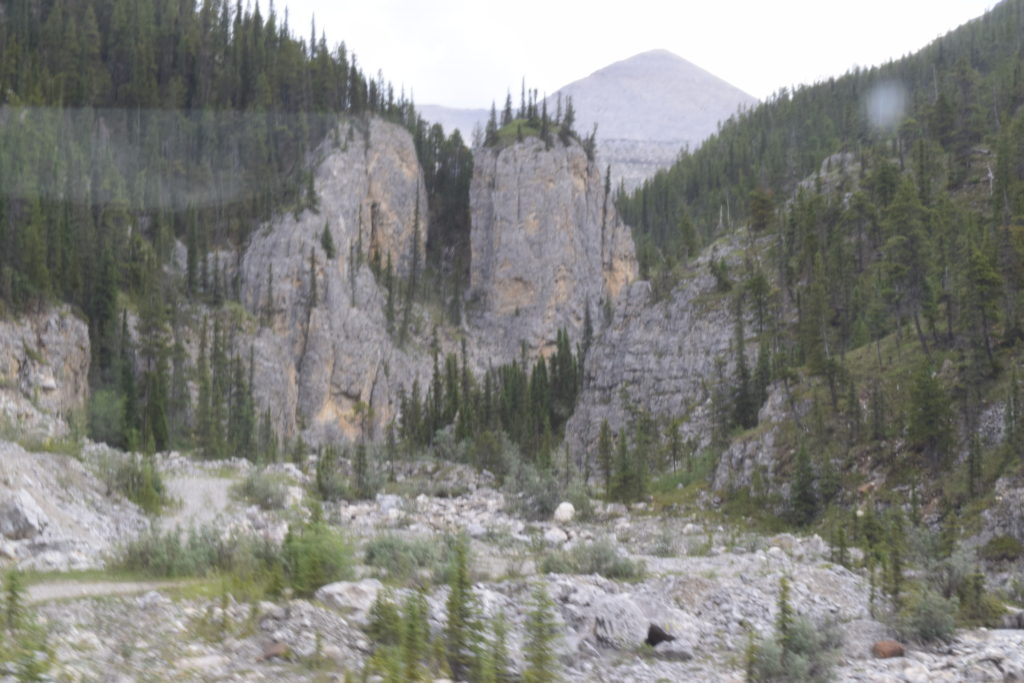
Since leaving Dawson Creek, the 0 mile marker of the Alaska Highway, we seem to be skirting the eastern edge of Canadian Rockies, but have had some long slow climbs along with the inevitable descent.    According to The Milepost Alaska Travel Planner, one section we drove today used to be called “Suicide Hill” because it was one of the most treacherous hills on the original highway. Today it is still precipitous at 6% and 9% grade.  I take my hat off to Bob for his managing of the descent.  We stopped at the brake check area before starting down.  The turn into the pull off was sharper than it looked so the brakes got a good test.  After have a bit of lunch we set off down the mountain.  As we pulled out it started to rain. OK, deep breath. At first it was just steep and winding, then, close to the bottom, there was road construction and the road surface was a mixture of mud and loose gravel.  I held my breath.  We made it safe and sound and no burning brake smell.

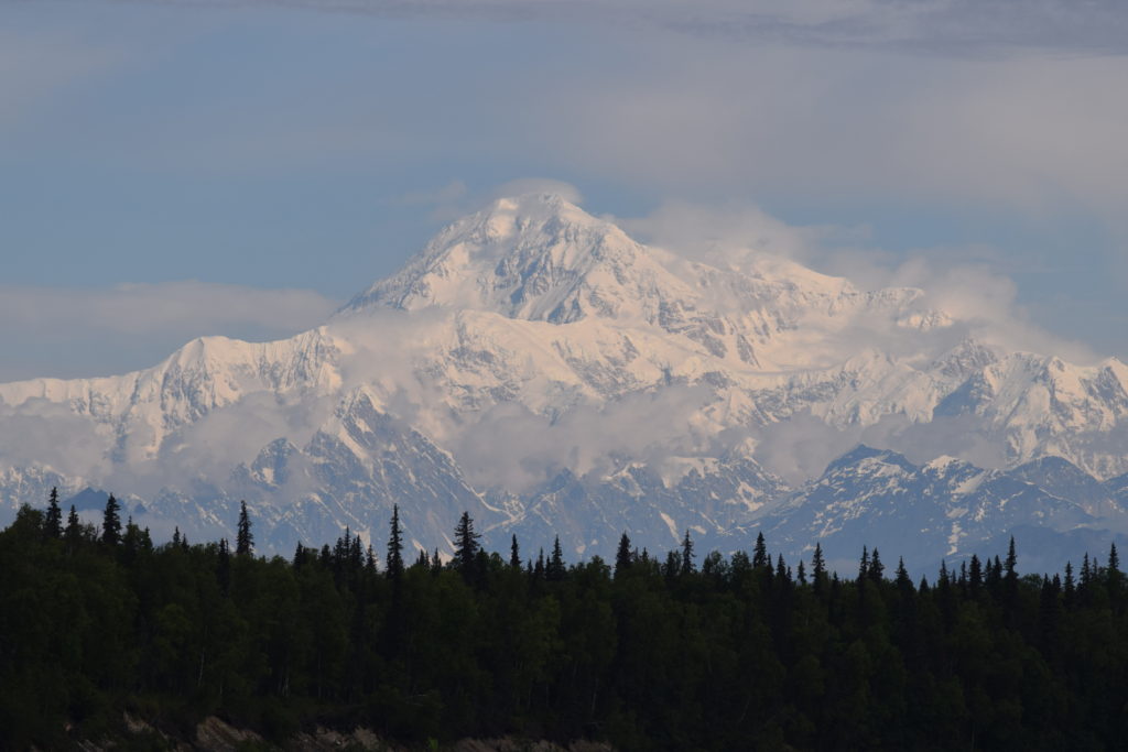
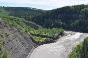
The scenery is spectacular, lush green in varying shades with white birch interspersed.  We drove through two areas that had burned, the first looked like a controlled burn because there was still growth on some of the trees.  The second was the result of a forest fire last year that jumped the highway.  Over 8000 acres were burned and at one point the highway was closed due to smoke.  There are still signs up informing drives of the fire area and warning us that we enter at out own risk.

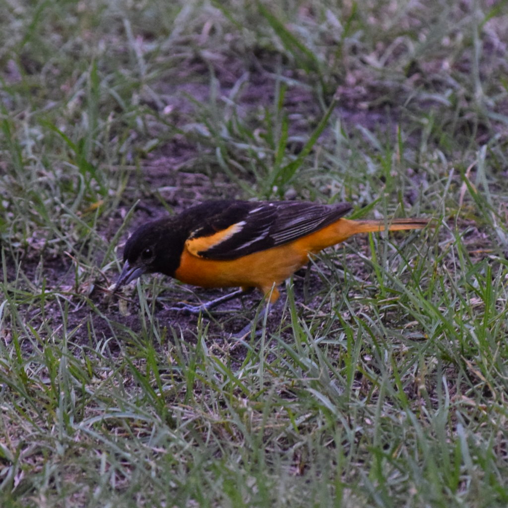
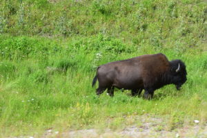
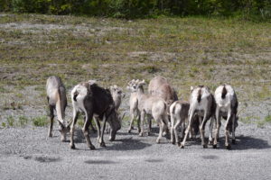
There are also game crossing warnings everywhere.  Bob saw 3 deer and I saw a moose/elk carcass. I could not tell which.  I did see 2 reddish brown crane like birds.  I have looked through field guide and have not found anything close in appearance whose range is in this area.  I will have to try another guidebook.

It is a lovely, cool evening and I should take a walk to burn off the Saskatoon berry crisp I made for dessert.

Until the next time.

I love you all!

Cora